Hopewell Arch, Copperas Falls, and Box Falls
/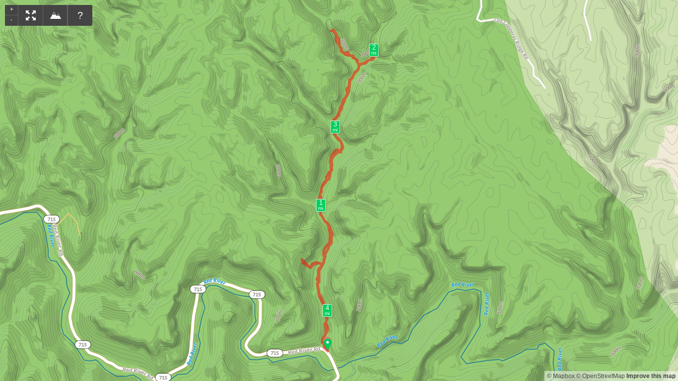
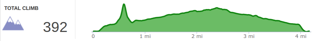
Overview. This is a seemingly short hike at just over four miles, but it takes a good bit of time if you want to keep your feet dry-ish. Plan for a half day or more to explore this hike that is unmarked and has some challenging (sometimes extremely so) sections. The falls are beautiful and Hopewell Arch is among my favorites.
Options. For an easy day, skip Hopewell Arch and Box Falls. Add a little navigation challenge and a scramble with Hopewell Arch. Test your wilderness skills and patience with Box Falls - a truly wild area with no semblance of a trail and passable routes in short supply thanks to thick rhododendron growth.
Route Type | Out and Back with Spurs
Total Distance | 4.16 miles
Overall Difficulty | Moderate with Strenuous Sections
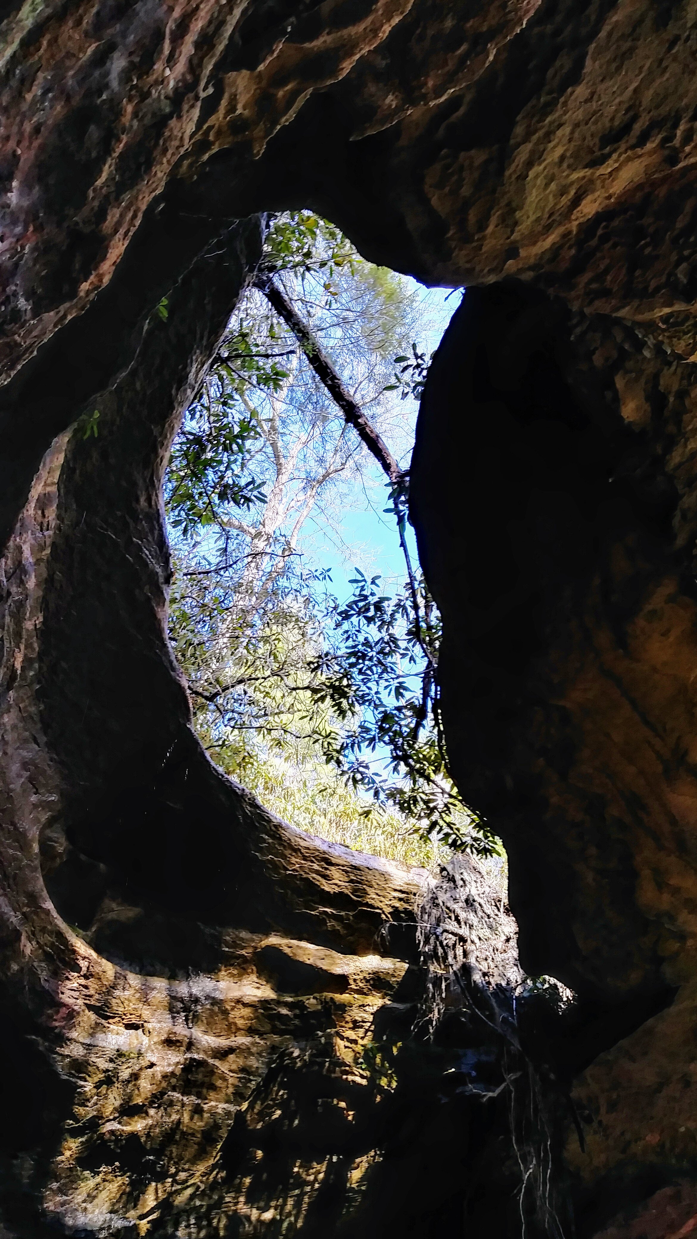
Hopewell Arch | 37.827139, -83.577722
Turnoff to Hopewell Arch | 37.826361, -83.576556
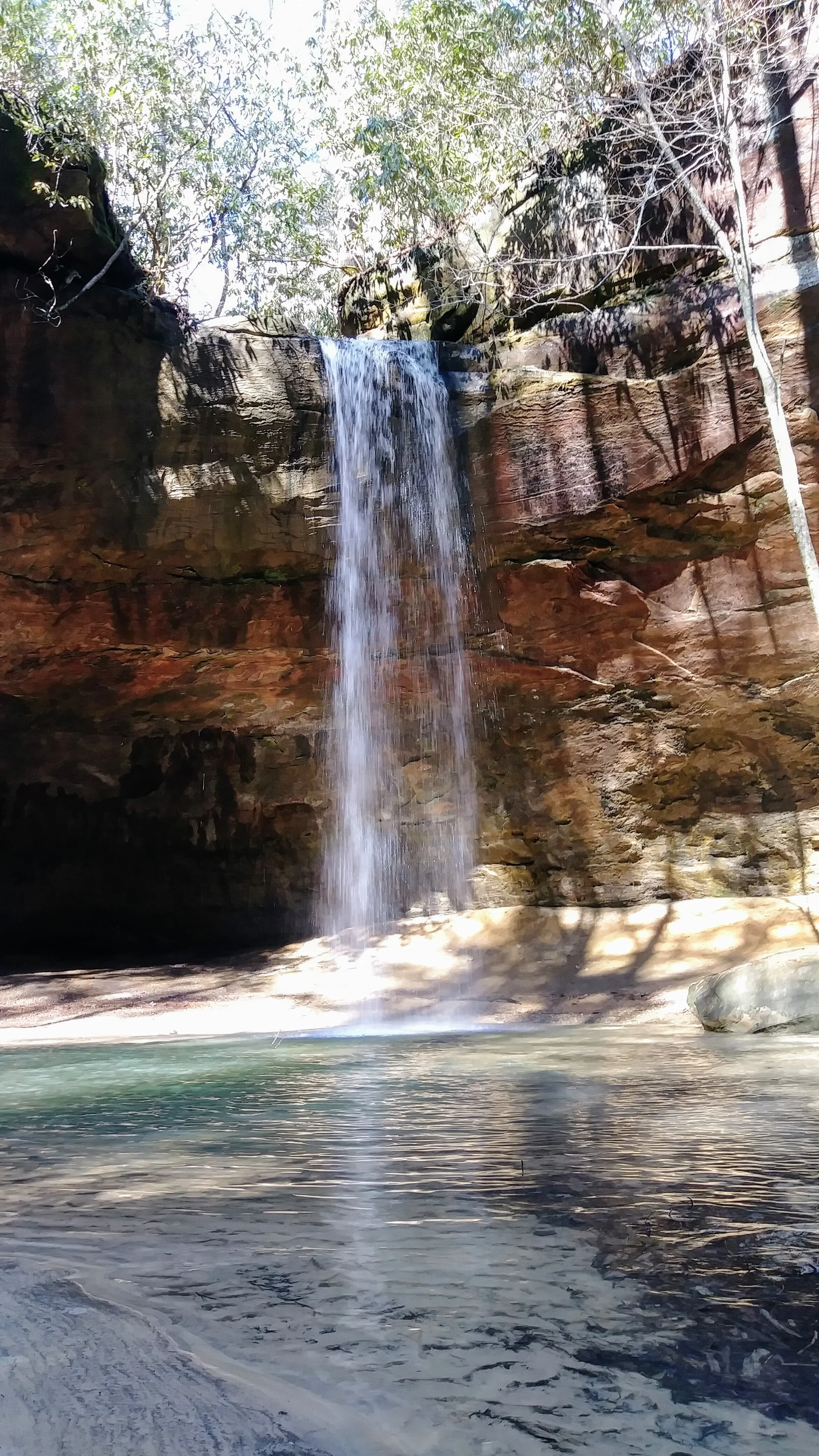
Copperas Falls | 37.841064, -83.571540
Box Falls | 37.842824, -83.575024
Copperas Creek Drain | 37.829808, -83.575677
*this hike is unmarked and difficult to navigate
Trailhead. Park at the Osborne Bend Parking Lot on KY-715 just west of the one lane concrete bridge. [map]
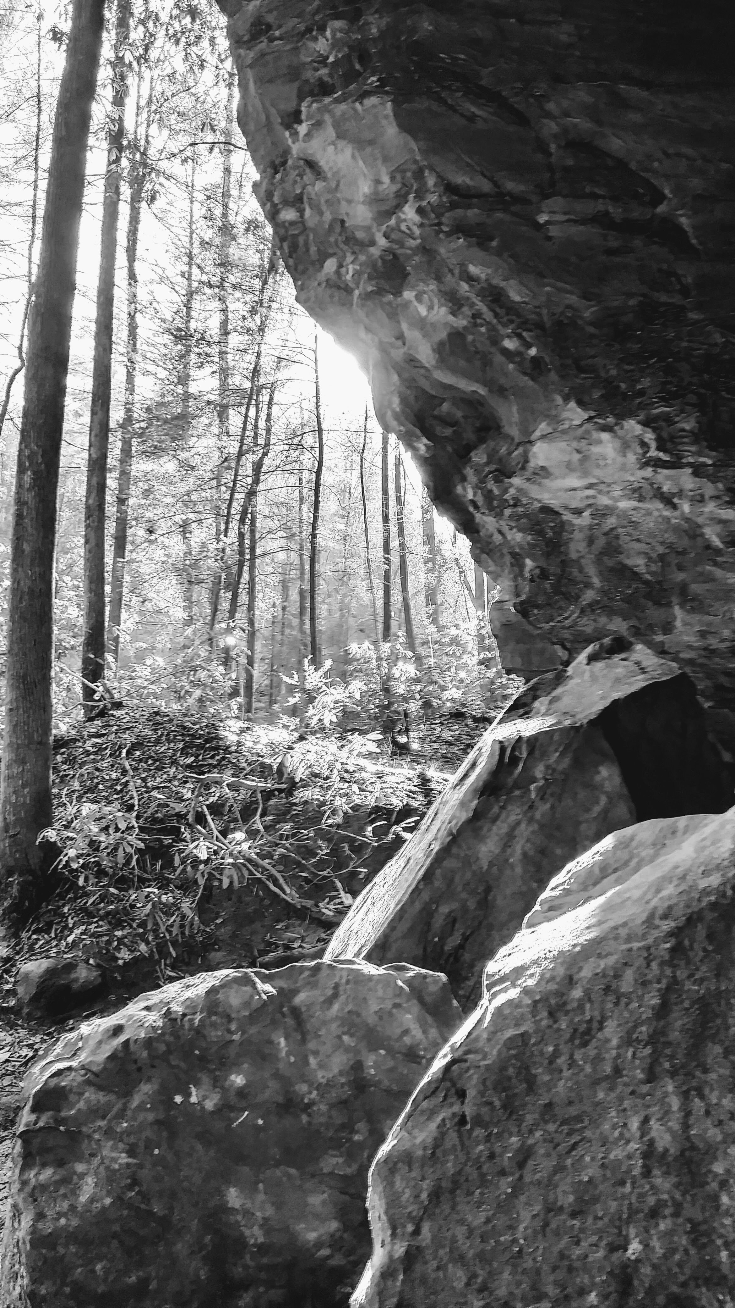
Trail navigation - Hopewell Arch. This hike begins from the Copperas Creek parking area just west of the Osborne Bend lot. Take either of the pathways and begin moving uphill until reaching a false top with a truly gigantic boulder to the left of the trail. Just beyond this is a drainage that you’ll descend to reach the creek bed. Across the creek, find a small boulder with a well trod trail to the right that moves uphill behind it. Continue on this path until reaching an old roadbed and turn left (south). The trail ahead will appear to be blocked, but there is a path beyond the vegetation. Cross the small drainage and travel a short distance to find some branches that have been placed to obstruct the trail. This is your marker to make a sharp right to continue your climb. The trail here is well traveled and firm underfoot. If it feels soft, you’re off the trail and should turnaround to regain the firm trail. Move uphill to find a cracked rock. Move left around the rock and follow the trail around it before seeing a log leaning against the cliff face. Make your way to the cliff face and follow it around until you reach some rocks that you’ll need to climb to reach the arch. There is an option just before reaching the plateau underneath the arch to go around, but be careful here to not hit your head and lose your balance. Alternatively, you can lift yourself up on some rocks to reach the plateau. [TURN-BY-TURN WITH PHOTOS]
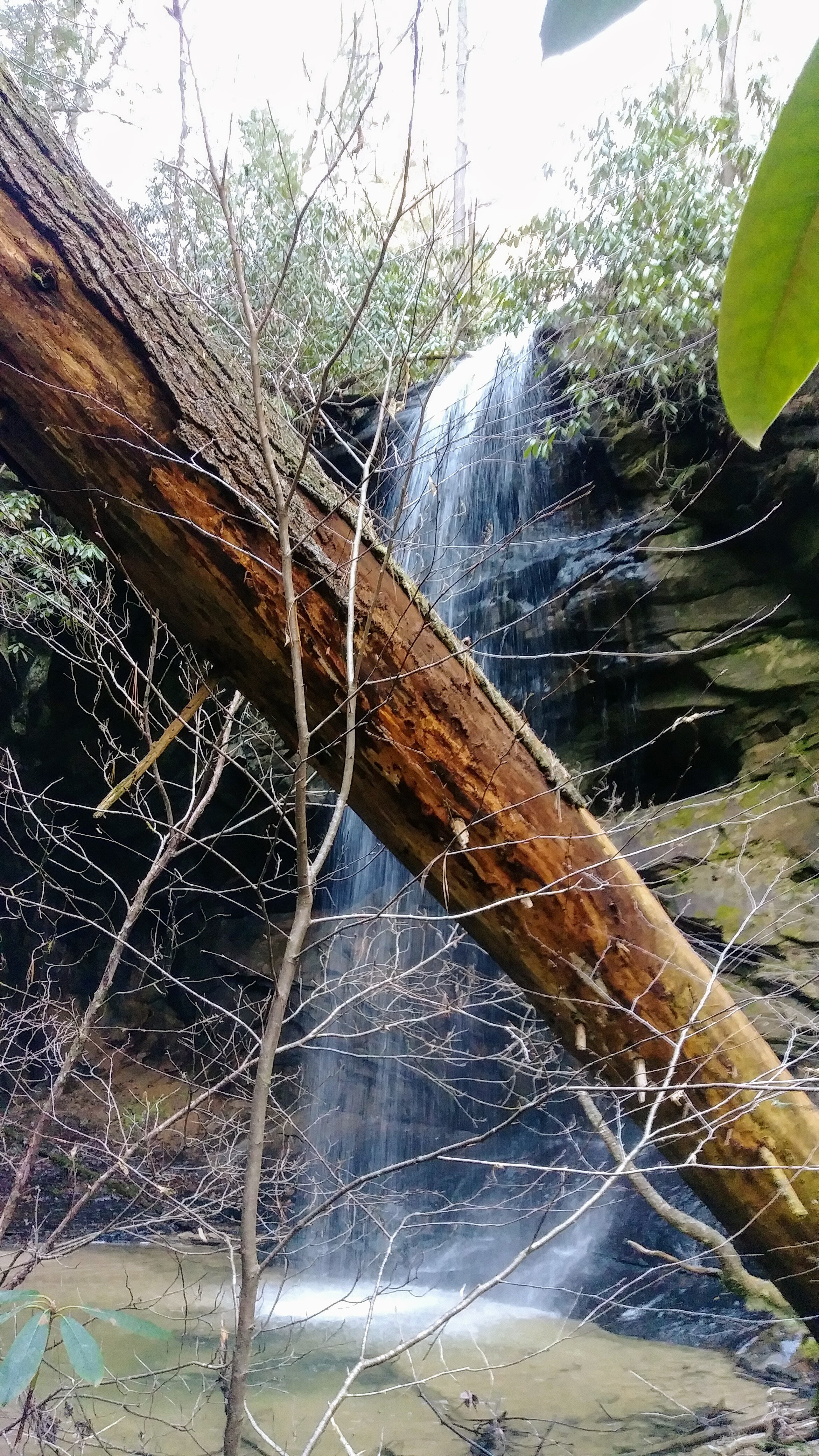
Trail navigation - Copperas Falls. Though unmarked, this is among the easiest trails to navigate. Simply follow the trails along Copperas Creek to reach the falls. When you get close, you’ll see some large boulders with cut tree stumps between them. This is the path to the falls and you should hear them before you see them.
Trail navigation - Box Falls. Reaching these falls is not for any ‘normal’ human being - you need to have a screw loose. It is a genuine test of patience, route finding, and willingness to get soaking wet because at several points, the only route is up the creek or a side drainage of muck. These falls are very seldom visited and no firm footing is available once you leave the Copperas Falls/Creek vicinity. I didn’t see any game trails either, so it’s isolated to be sure. If you’re not up for it OR if you’re hiking alone (your body will likely never be found), I would skip this altogether. That said, here are some tips on how to get there:
From Copperas Falls, head back toward the trailhead and at 0.10 miles, look for an open spot on the north/west side of the creek before another creek intersects with it
Head northwest away from the other creek and more toward the cliff face to the north
Make your way around here that has some firm footing until you get a little further northwest
From here, it’s a quarter mile to Box Falls through some challenging terrain
When a route looks impossible, retrace your steps and try another route
As a rule, I hiked up along the creek and on the north side secondary drainages where the creek was impassable, taking one secondary drainage over to the next secondary drainage before returning to the creek
Once the falls are in view, it’s easiest to simply walk up the creek that has a solid rock bed until reaching the area beneath the falls - it may take an hour or more for you to navigate this quarter-mile spur
Reach the falls at GPS | 37.842824, -83.575024
CAUTION - Cliffs. Be careful to avoid getting too close the edge of cliffs, as this is the leading cause of serious injury and death when hiking in Red River Gorge.
CAUTION - Poisonous snakes. While the gorge is within the range of timber rattlesnakes, copperheads are the most common poisonous snake encountered. Stay alert on the trail, as snakes are commonly found taking in the warmth of the trail. Give them a wide berth or wait for them to move off the trail.
CAUTION - Bears. Black bears are growing in number throughout Daniel Boone National Forest. Be sure to follow bear safety precautions. [Be Bear Aware by US Forest Service]