Upper Norton Reservoir Loop
/
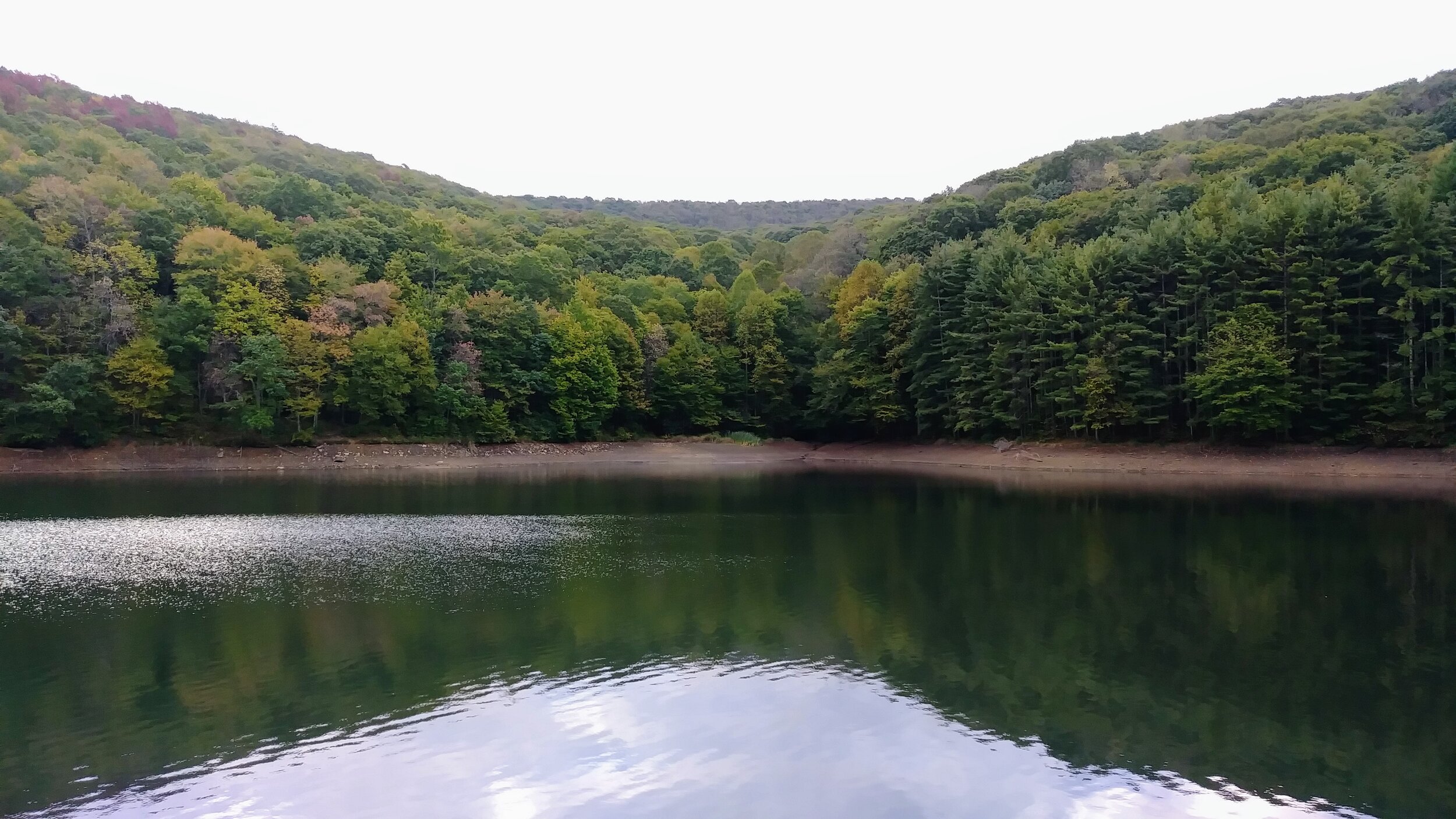
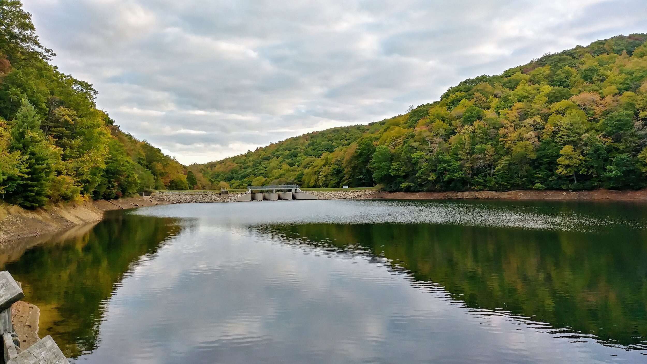
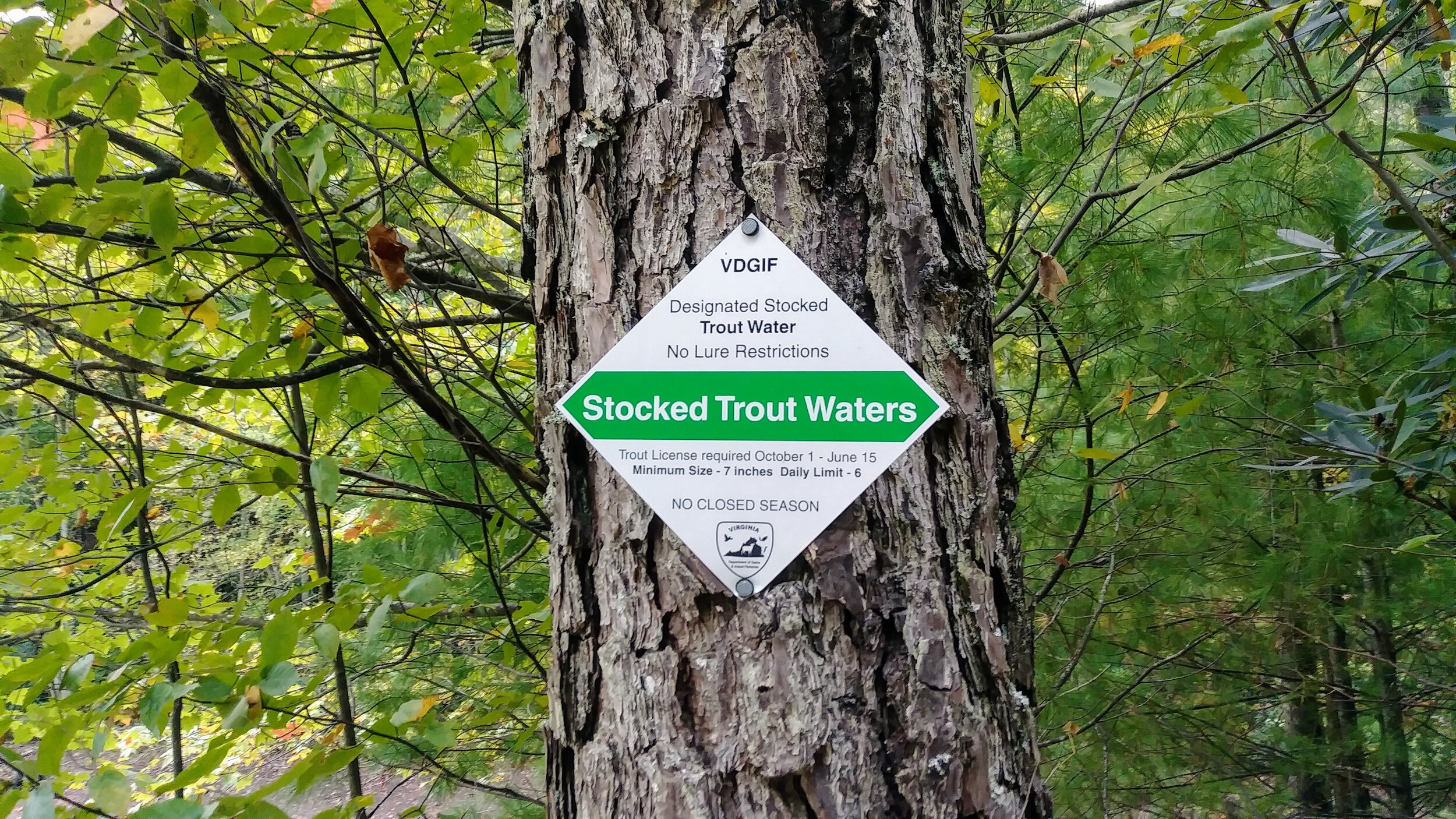
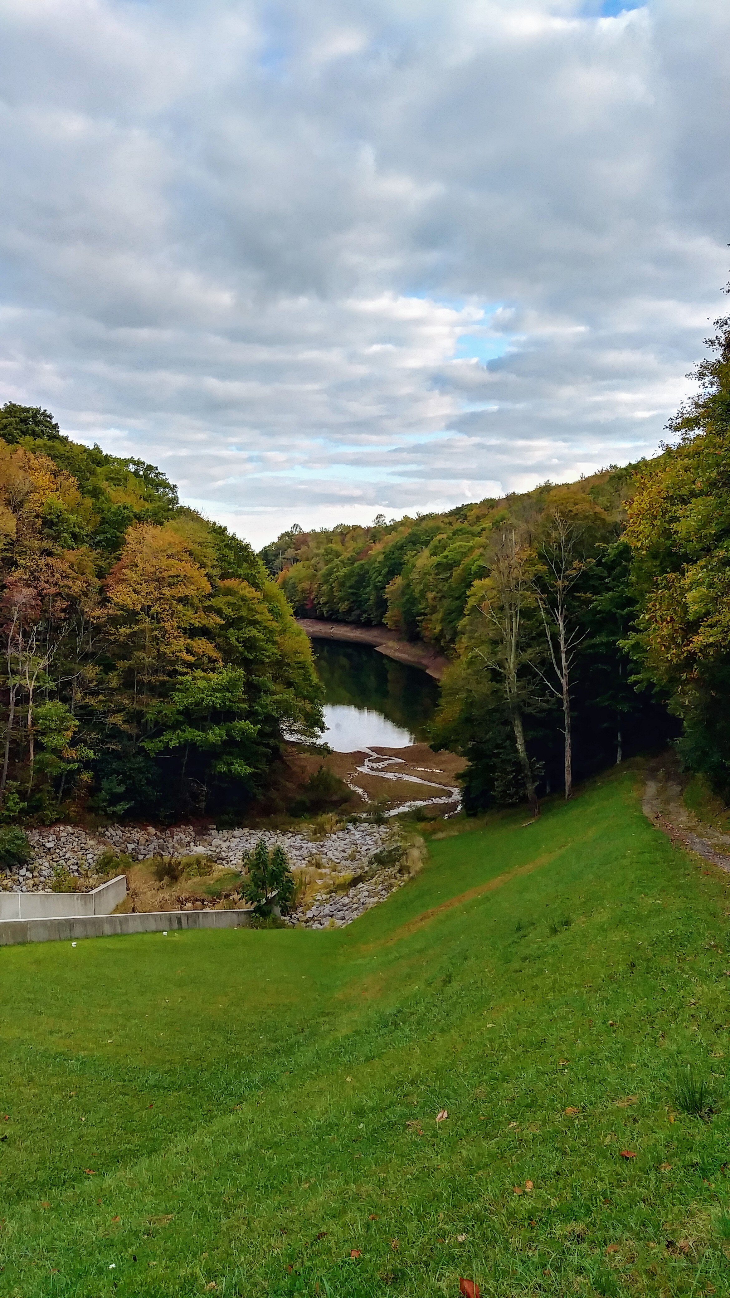
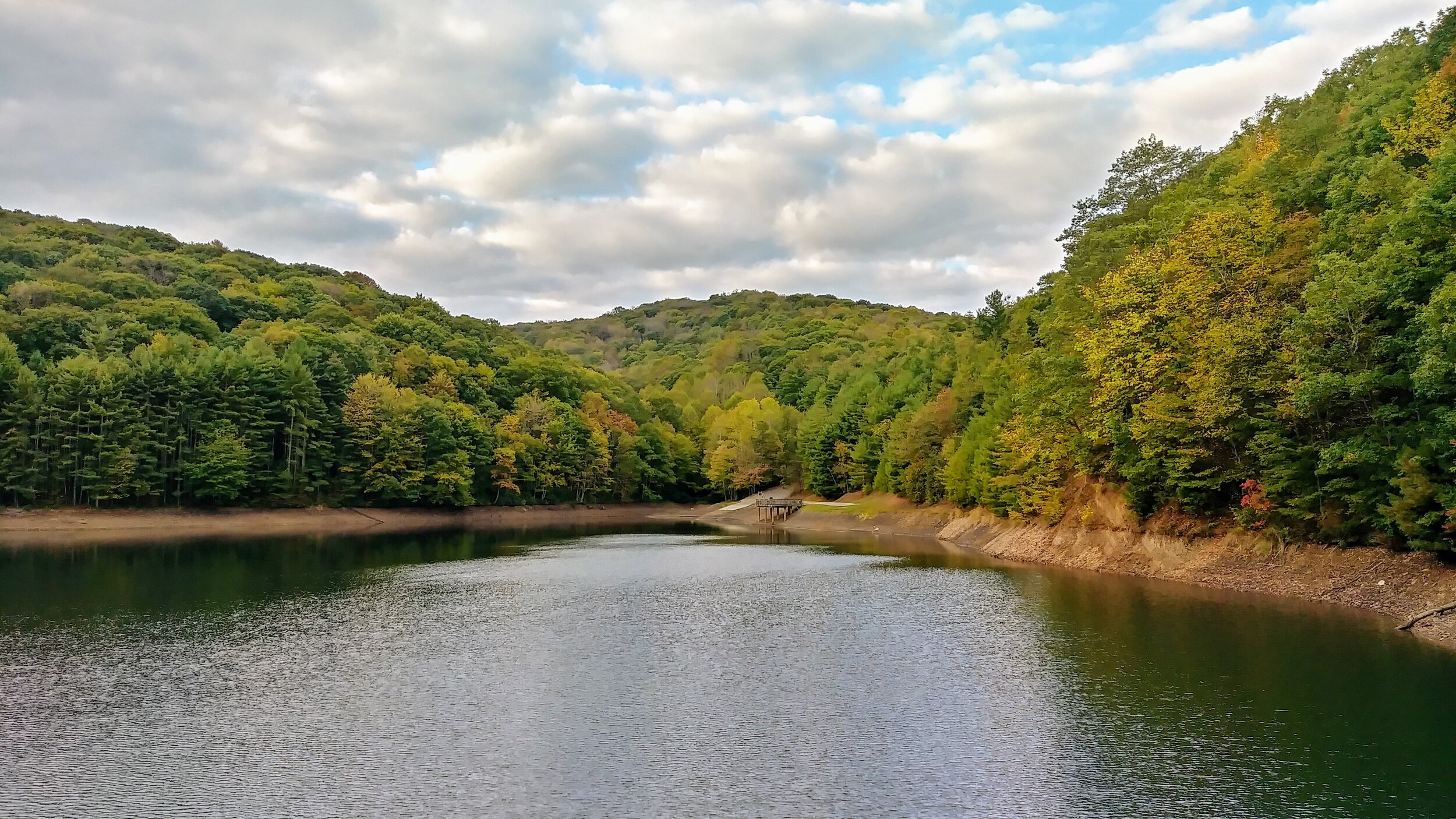
Overview. This is a nice, short hike around the uppermost of two reservoirs on the mountainside above Norton, Virginia. It’s a peaceful walk on wide, well maintained hiking trails with plenty of intersecting biking trails along its length. For those who enjoy fishing, it would appear plenty of trout can be found in these waters.
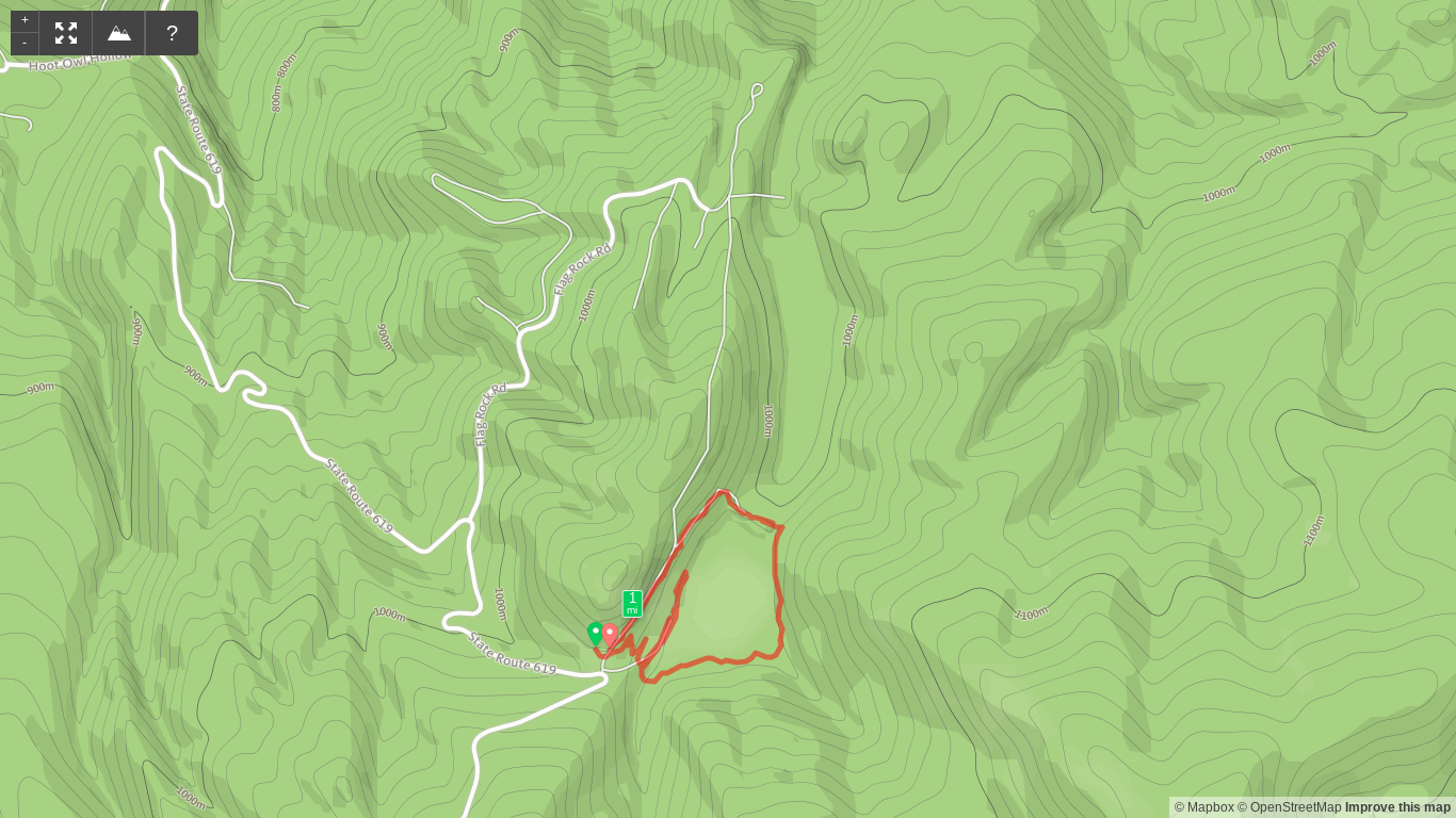
Route Type | Loop
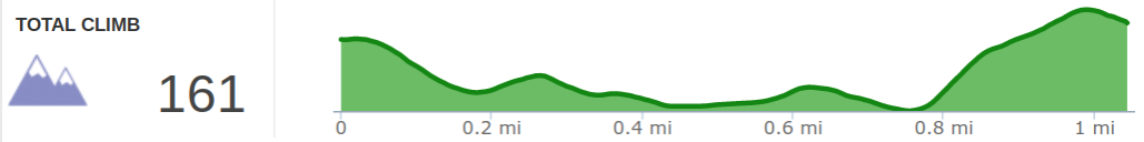
Total Distance | 1 mile
Overall Difficulty | Easy
Flag Rock Recreation Area Trail Map
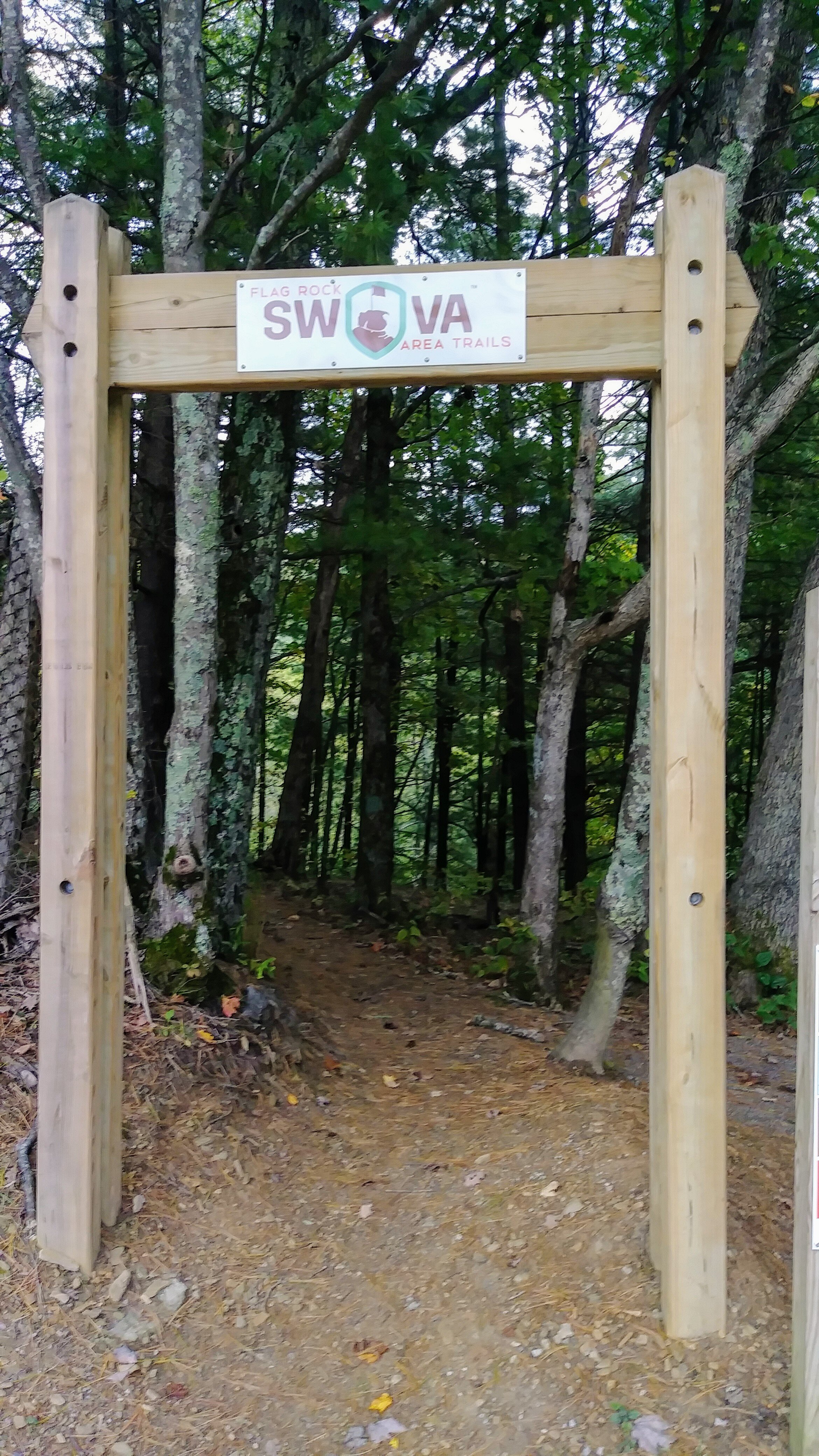
Trailhead. There is an expansive parking lot at the trailhead just off VA-619. [map]
Trail navigation. I hiked the loop counterclockwise and the trail is easily navigated. At intersections, take the low option nearest the lake. The little out and back section on the map above is a user trail beyond the road that no doubt has been used by fishermen.
Add the Lower Reservoir and Flag Rock. You can easily tack on an extra couple miles checking out the Lower Reservoir and Flag Rock. While visiting Flag Rock, be sure to visit the rock formation just off the covered picnic tables. And, keep your eye out for Woodbooger:-)
CAUTION - Poisonous snakes. Copperheads and timber rattlesnakes can be found in the area. Stay alert on the trail, and if you see one, give it a wide berth or wait for it to move off the trail.
CAUTION - Bears. There are plenty of black bears in the area, so it pays to take appropriate precautions including bear-safe food storage, carrying bear spray (especially when hiking alone), and knowing what to do when you encounter a bear. [Be Bear Aware by US Forest Service]